

MAYSVILLE, KY, USA, Nov 29, 2023 – Carlson Software announced the release of its simple, fast, and accurate 3D handheld scanning solution for iOS and Windows, Scan3D. Offering the perfect complement to drone photogrammetry and other traditional scanning methods, Scan3D provides point cloud information for those impossible-to-view spaces such as the edges of buildings and areas obscured by overhangs or trees.
The Scan3D workflow provides a simple and affordable path to add Scan3D point cloud data to other clouds, creating more complete, more accurate, and more useful scans and finished CAD deliverables. An example workflow would begin with a photogrammetry drone flight to capture the majority of a site, processed to a point cloud in Carlson PhotoCapture.
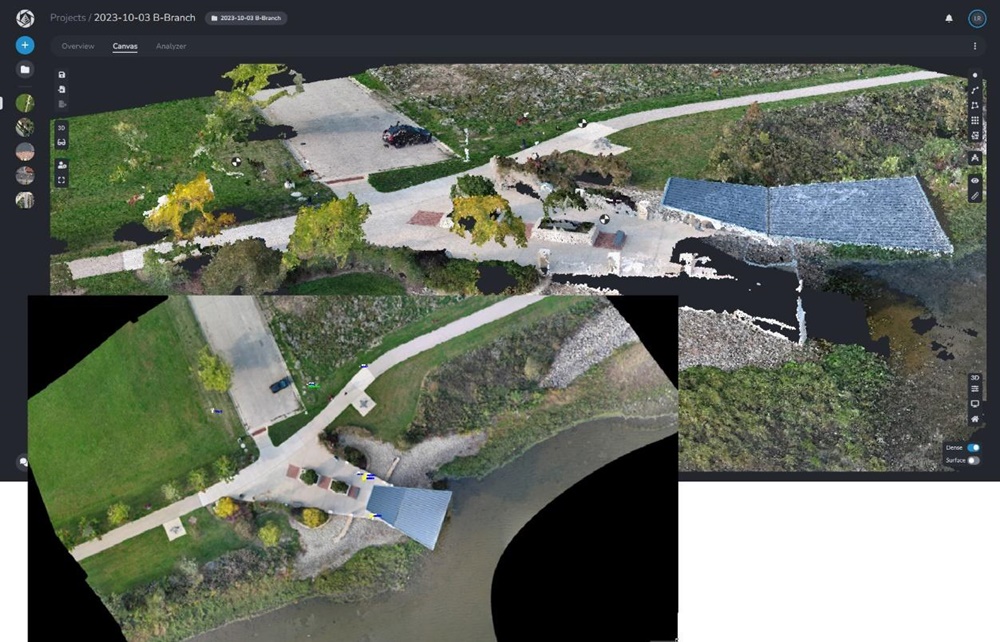
Scan3D is then employed to create its own point cloud of the incomplete areas that were obscured by foliage or building design.
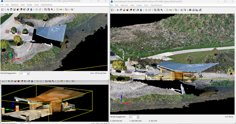
The resulting point clouds are then merged in Carlson Point Cloud to create a more detailed, more accurate, and ultimately more useful cloud to be used to create CAD deliverables or for any other purpose.
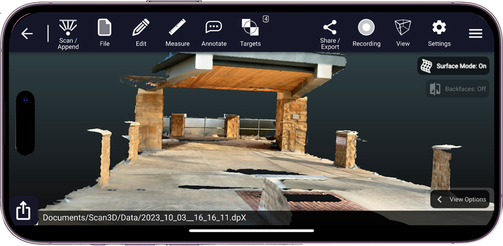
Running in either Windows or iOS, Scan3D utilizes either an Intel® RealSense stereo camera on Carlson’s RT5 or RTk5 rugged tablets or the built-in LiDAR and camera sensors on an iOS device such as iPhone Pro or iPad Pro. Scan3D adds a new tool to the truck for surveyors, engineers, construction professionals, accident reconstruction specialists, and anyone else needing instant, mobile 3D scanning of buildings, walls, spaces, equipment, and much more.
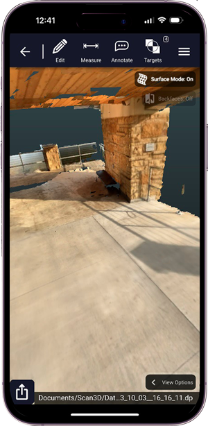
Scan3D is capable of precise measurements of distance, area, and volume, as well as direct, color 3D point cloud export in DP, E57, RCS, LAS, LAZ, and other formats.
The Scan3D solution relies solely on local processing, meaning no cloud processing or internet connection is required to scan or create a finished point cloud. These resulting point clouds can be merged with larger scale clouds from sources such as terrestrial laser scanners, aerial LiDAR, or aerial photogrammetry to create a single model with accurate coverage of areas that no single device could produce.
Learn more about Carlson Scan3D by visiting our website here, or contact your Carlson Software Representative or Certified Dealer for pricing, a demo, and to purchase. Scan3D for iOS offers a 7-day free trial and can be found on the App Store here. To locate your representative or dealer, click here.
About Carlson Software
Founded in 1983, Carlson Software Inc. specializes in CAD design software, field data collection, laser measurement and machine control products for the civil engineering, surveying, GIS, construction, and mining industries worldwide, providing one-source technology solutions for the entire project cycle. Carlson Software is headquartered in Maysville, Ky., U.S.A., with branch offices in Boston, Mass.; Almere, The Netherlands; Melbourne, Australia; Ottawa, Canada; and York, England. For more information, visit https://www.carlsonsw.com.

")